HISTORY & RESEARCH
Nevadaville Through the Historical Record
Nevadaville’s historic landscape can be explored through maps, photographs, archival records and the structures that remain. NHF is bringing these sources together to help document the town’s history and share what they reveal about this Colorado mining community.
SELECTED SOURCES
Featured Historical Records
Historic maps and photographs provide dated evidence that can be compared with Nevadaville’s surviving buildings, foundations and streetscape.
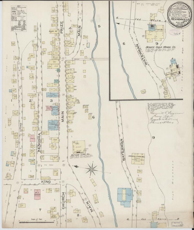
Sanborn Fire Insurance Map of Nevadaville, Gilpin County, Colorado, August 1886.
Sanborn Map Company. Library of Congress, Geography and Map Division, Sanborn Maps Collection.
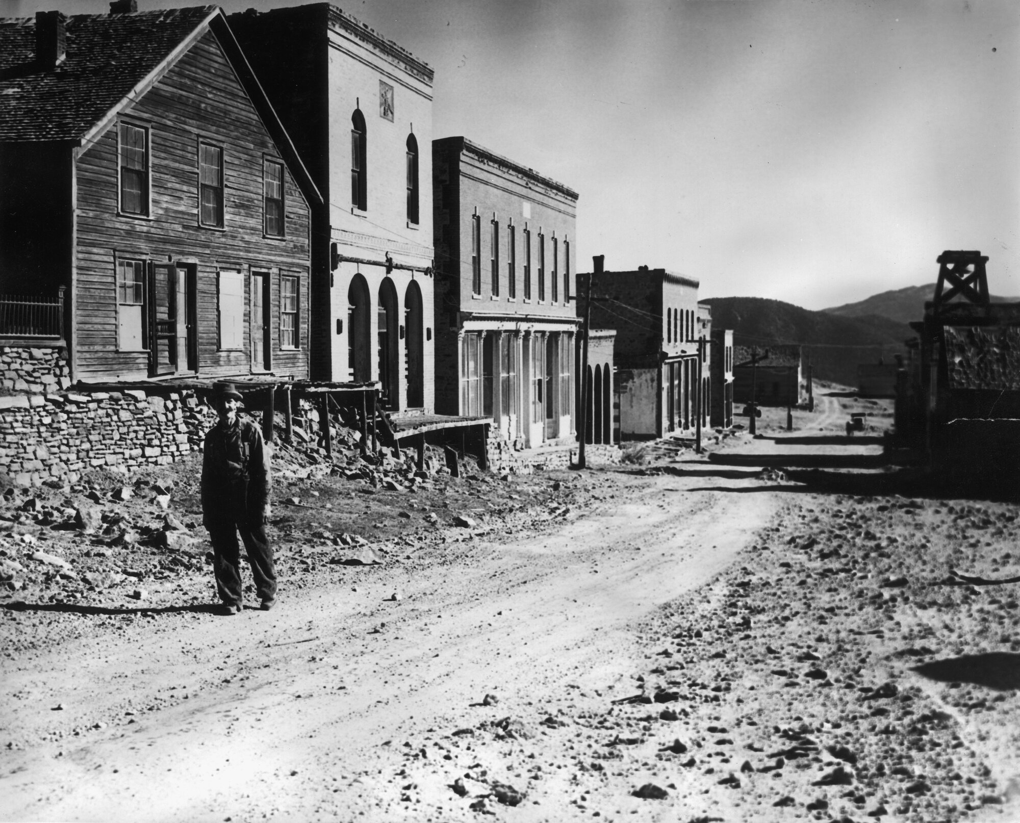
Historic view of Main Street in Nevadaville, Colorado, with Leonard Nichols, circa 1931–1935.
Denver Public Library Special Collections, X-12490
Preserve, document, interpret and share Nevadaville’s historic resources and stories for public benefit.
Connect
Nevadaville Heritage Foundation is a Partner Project of Colorado Nonprofit Development Center, a nonprofit charity exempt from federal income tax under Section 501(c)(3) of the Internal Revenue Code.
© 2026 Nevadaville Heritage Foundation